
SOTA — Summits On The Air
Why not join in with HB9SOTA — mountain radio is great fun!
What is SOTA?
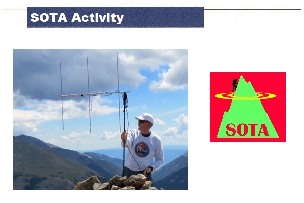
All over the world, many hams regularly operate from mountain summits. This growing branch of amateur radio is known as Summits on the Air, or SOTA for short. It was launched on 2 March 2002. Anyone who makes SOTA activities part of their hobby is either an ‘Activator’ of a valid mountain, a ‘Chaser’ who makes a QSO from home with the climber on the mountain, or an SWL. QSOs between two activators on different mountains – known as Summit-to-Summit QSOs (S2S QSOs) – are particularly popular. Mountain radio is especially well-suited to QRP enthusiasts, those affected by antenna or electromagnetic pollution, or those who are overweight (hehe)!
Who is HB9SOTA?
The international SOTA management team promotes radio activity from mountain summits via a cluster/reflector (SOTAwatch2), a database of completed QSOs, an attractive diploma program and the website www.sota.org.uk. Each country or DXCC association has its own organisation, which compiles a valid mountain list.
In Switzerland, this is the HB9SOTA association. It designates the approved peaks (saddle height min. 150 m), organises mountain hikes and the Swiss Mountain Activity Day, and sends out a regular newsletter. Register with the association via hb9sota.ch/anmelden — membership fee CHF 20.– per year.
What rules do you need to follow for SOTA?
All radio amateurs worldwide can take part in the SOTA programme. All modes and amateur bands authorised in the relevant country are permitted. For your mountain activation to be valid, you must complete at least 4 QSOs. You may operate from the highest point of the mountain within an activation zone of 25 metres in altitude. You must cover the final section of the route on foot — operating from or in the immediate vicinity of a vehicle is not permitted, nor is connecting to the car battery. Connections via repeaters are not permitted. You can find the full rules at sota.org.uk/Joining-In/Guidelines.
Swiss Mountain List
The Swiss Mountain List contains over 1,300 peaks of all levels of difficulty — from hiking peaks to climbing peaks. You can also reach many Swiss mountains by cable car, gondola or rack railway (hb9sota.ch/bahnli-gipfel) or, in winter, on snowshoes (hb9sota.ch/schneeschuhtouren). The current list of Swiss mountains is available as a PDF: ARM-HB-German.pdf.
How is the SOTA mountain reference structured in Switzerland?
Every SOTA mountain reference in Switzerland begins with HB, followed by the canton abbreviation and a three-digit number in the range 001–999. The Säntis, for example, has the reference number HB/AI-001.
The higher the mountain, the more points you receive for activating it:
- up to 1,000 metres above sea level → 1 point
- 1,000–1,500 metres above sea level → 2 points
- 1,500–1,750 metres above sea level → 4 points
- 1,750–2,000 metres above sea level → 6 points
- 2,000–2,500 metres above sea level → 8 points
- above 2,500 metres above sea level → 10 points
For a summit to count as a separate SOTA mountain, it must rise at least 150 metres in elevation (saddle height) above the surrounding terrain on all sides — meaning the descent before the ascent to the next valid summit must be at least 150 metres.
What diplomas can you earn with SOTA?
Activators and hunters can apply for various diplomas at different levels of difficulty via the SOTA-UK web shop. 1,000 points lead to the famous ‘Mountain Goat’ diploma for activators or the ‘Shack Sloth’ for hunters.
HB9SOTA also issues its own diplomas — for activators, hunters, S2S QSO’s and SWLs — in the categories Alpenrose (6 cantons), Enzian (14 cantons) and Edelweiss (25 cantons). Apply for and have your diploma verified via hb9sota.ch/diplom. No QSL cards are required for SOTA diplomas; eligibility is verified automatically based on the QSOs uploaded to the SOTA-UK database.
What do you need for SOTA?
- Portable transceiver, rechargeable battery, fibreglass mast, antenna (terminated dipole, GP, frame antenna, etc.), Morse key and/or microphone, map and/or GPS (particularly recommended when abroad)
- Selection of a summit from the mountain list (sotadata.org.uk/summits.aspx)
- An account with SOTAwatch2 for spots and alerts on the reflector
- Recommendation: Announce your activity as an alert. When you post an alert, an automatic spot is sent via the Reverse Beacon Net (RBN) following the CW CQ call.
- Recommendation: Spot from your smartphone before starting operations — via a browser, SMS or an app (SOTA Goat, VK port-a-log, SOTA Log). Self-spots are encouraged when operating from a mountain.
- Activate the mountain with at least 4 QSOs
- Account with the SOTA database for uploading the log (sotadata.org.uk/register)
- Manual or electronic upload of QSOs — standard QSOs and S2S QSOs must be uploaded separately
- Optional sending of QSL cards
Further links
- SOTA Switzerland: www.hb9sota.ch
- SOTA International: www.sota.org.uk
- Practical information from René Lutz HB9NBG: lutz-electronics.ch/amateurfunk/sota-2
- Swiss mountain list (PDF): ARM-HB-German.pdf
- GPS tracks: wikiloc.com · sotamaps.org
- Maps of Switzerland: map.geo.admin.ch · schweizmobil.ch (for public transport access)
- Rigs & antennas: Elecraft KX2/KX3 (elecraft.com), Yaesu FT-817ND, SOTABeams, Lambda half-wave, LNR Precision
- Tracks & waypoints: sotamaps.org/tracks
- Tour reports: hikr.org
- Logging software: dl1dlf.de/rucksack_radio_tool · pignology.net (HamLog, SOTA app)
Video

Contact
If you have any questions or are interested in joining a mountain hike, the members of HB9SOTA will be happy to help — as will the president, Jens Nolte HB9EKO: ✉ jens_nolte@gmx.net